Feedback on routes from autumn 2024 engagement:
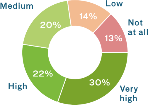
How important is it to you that we retain the alignment of Brunel Way in its current position?
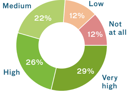
How important is it to you that we reduce the number of diversion roads to make room for other uses?
Existing view: key strategic routes - click to enlarge
Existing view: key strategic routes - click to enlarge
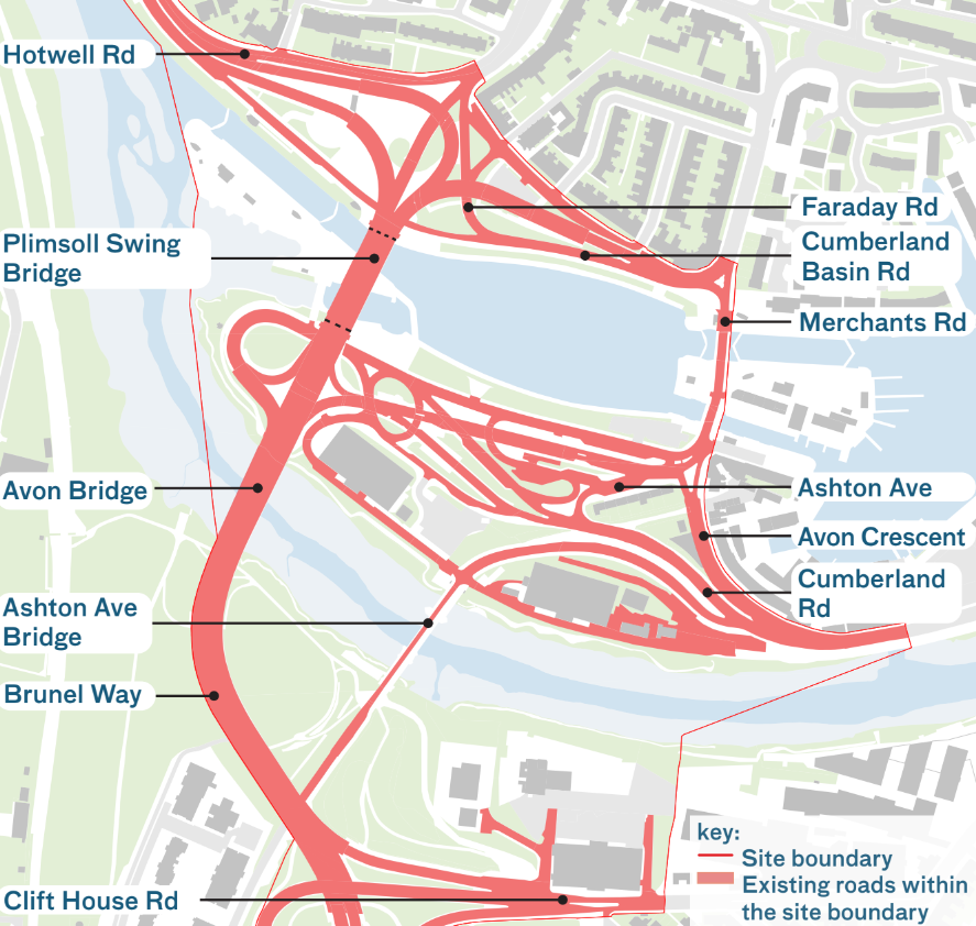
Existing road network within the site boundary - click to enlarge

Proposed road network within the site boundary - click to enlarge
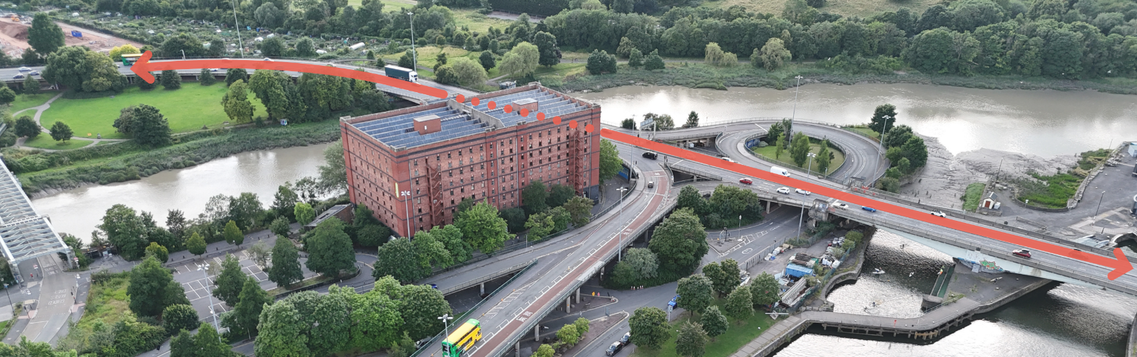
Existing Plimsoll Swing Bridge diversion routes
When the Plimsoll Swing Bridge swings open, traffic either queues along Brunel Way, or diverts along the south side of Cumberland Basin.
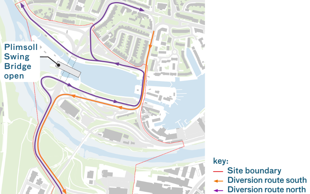
Existing Plimsoll Swing Bridge diversion routes - click to enlarge
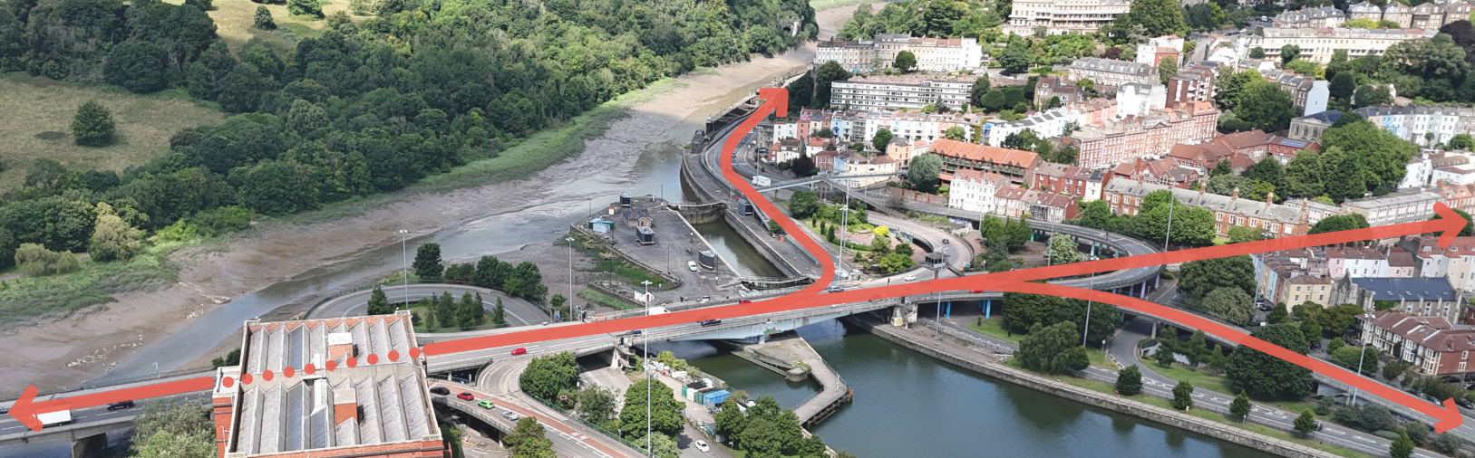
Proposed Plimsoll Swing Bridge diversion routes
The proposals maintain the southbound diversion route through Spike Island, with the northbound traffic held along Brunel Way.
Once Plimsoll Swing Bridge has been repaired the wait time will be reduced.
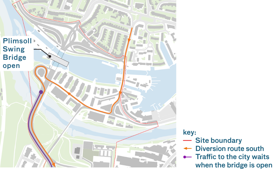
Proposed Plimsoll Swing Bridge diversion routes - click to enlarge
Additional information added 27.02.25:
Existing bus routes
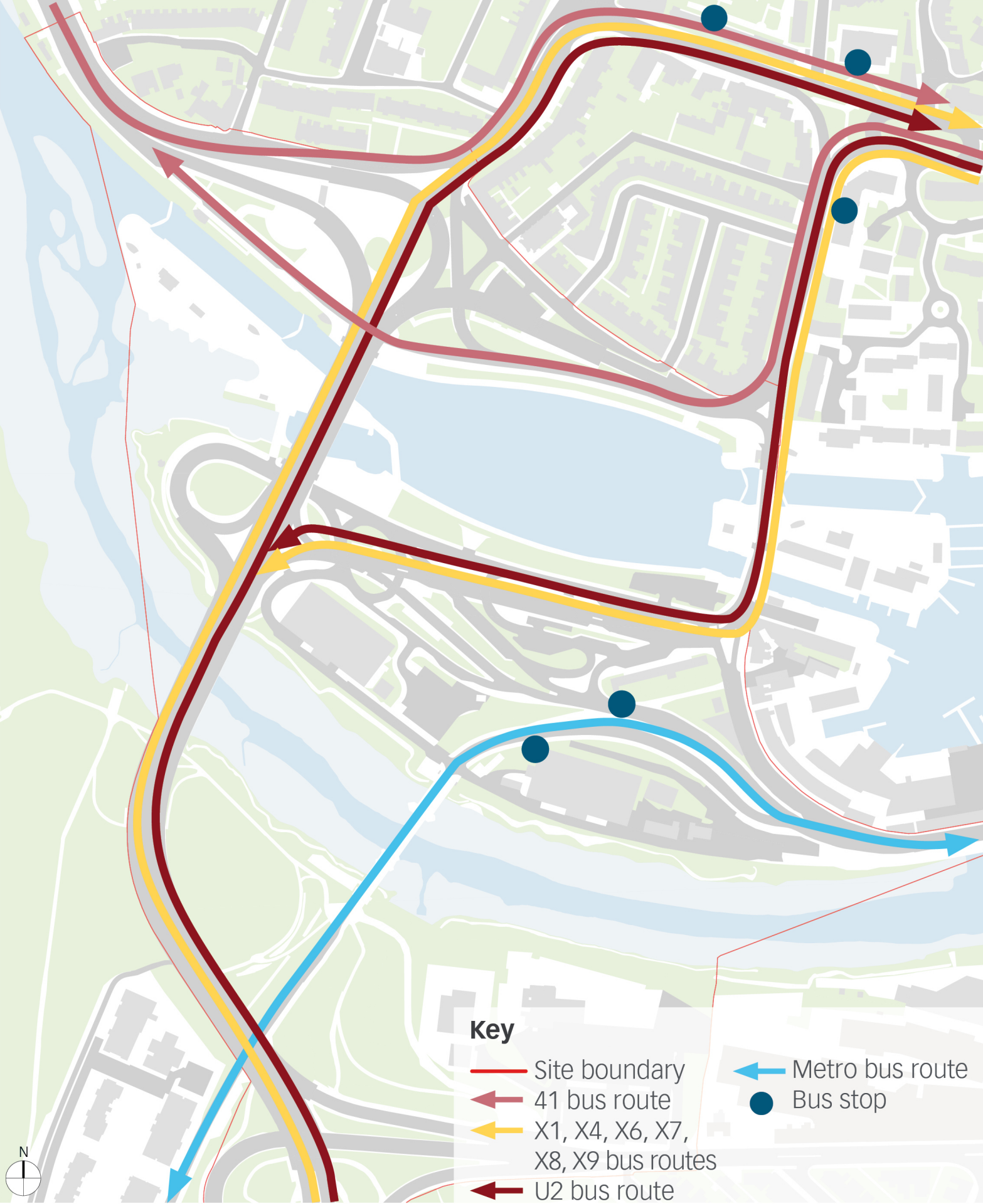
Existing bus routes - click to enlarge
Proposed bus routes
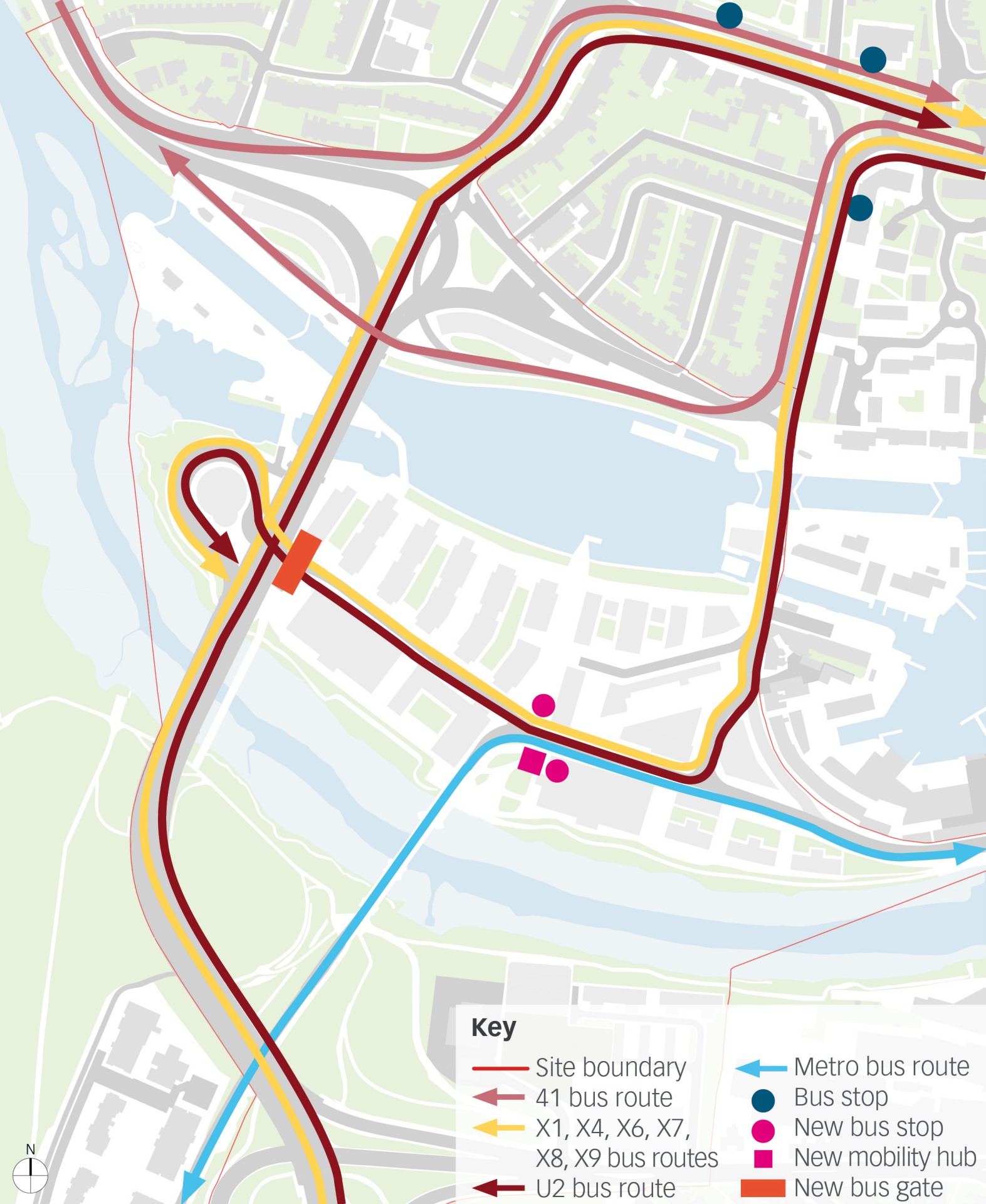
Proposed bus routes - click to enlarge