Feedback on flood defences from autumn 2024 engagement:
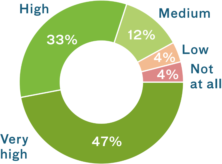
How important is it to you that we create new public realm for the city that is inclusive and offers beautiful spaces for people to enjoy the views?
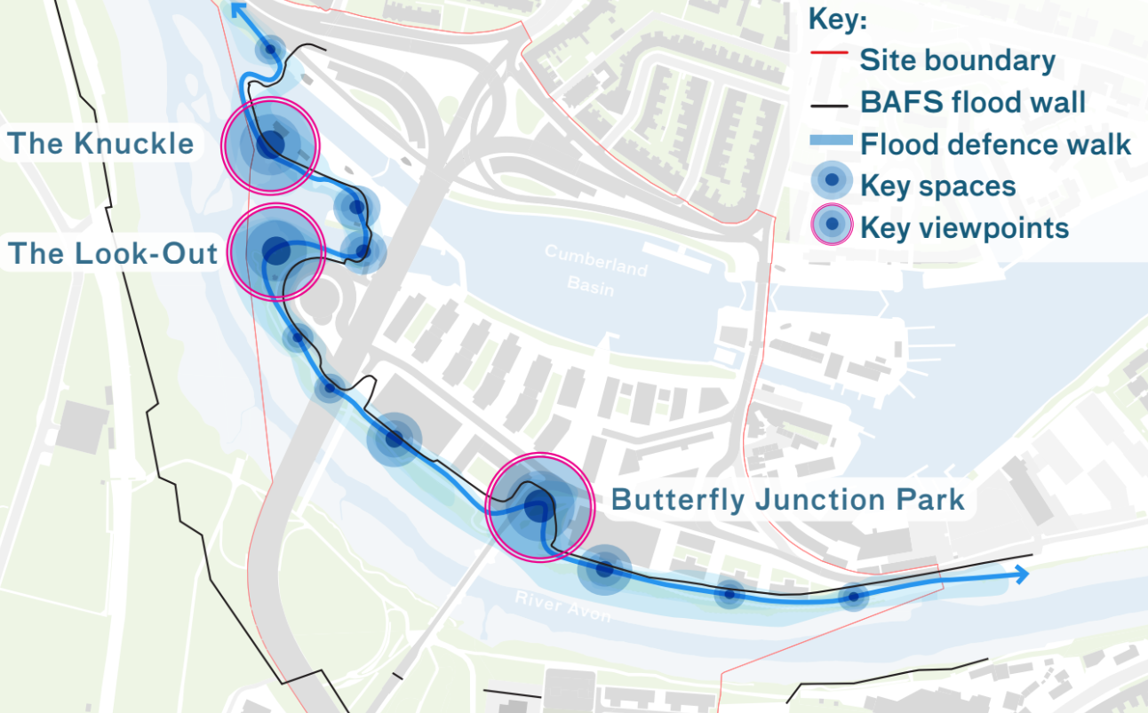
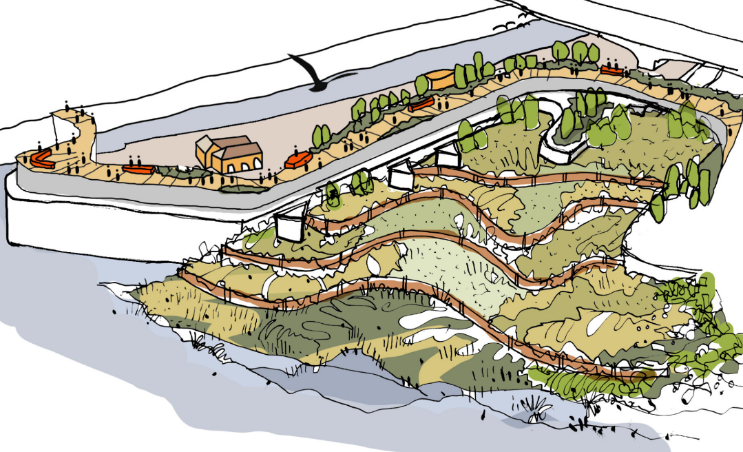
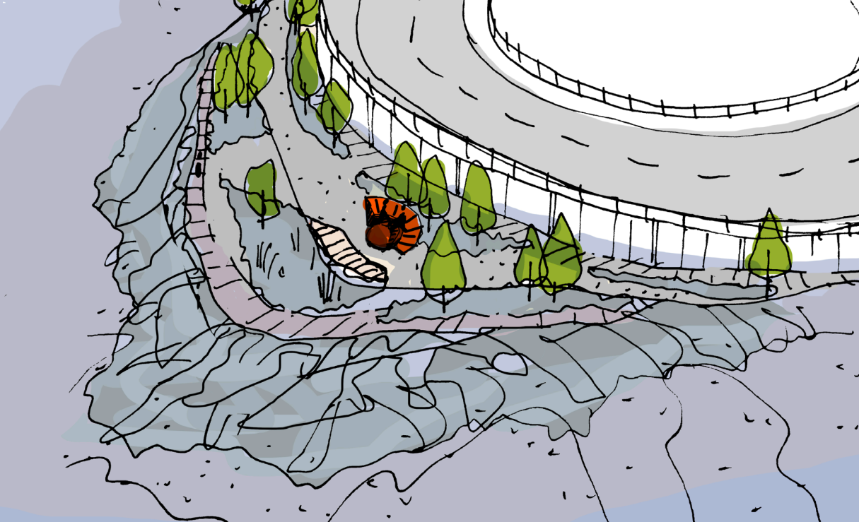
Proposed flood defence walk - click to enlarge
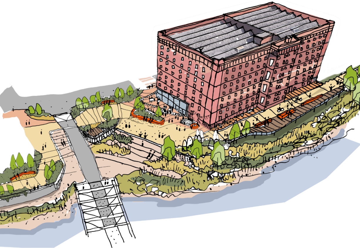
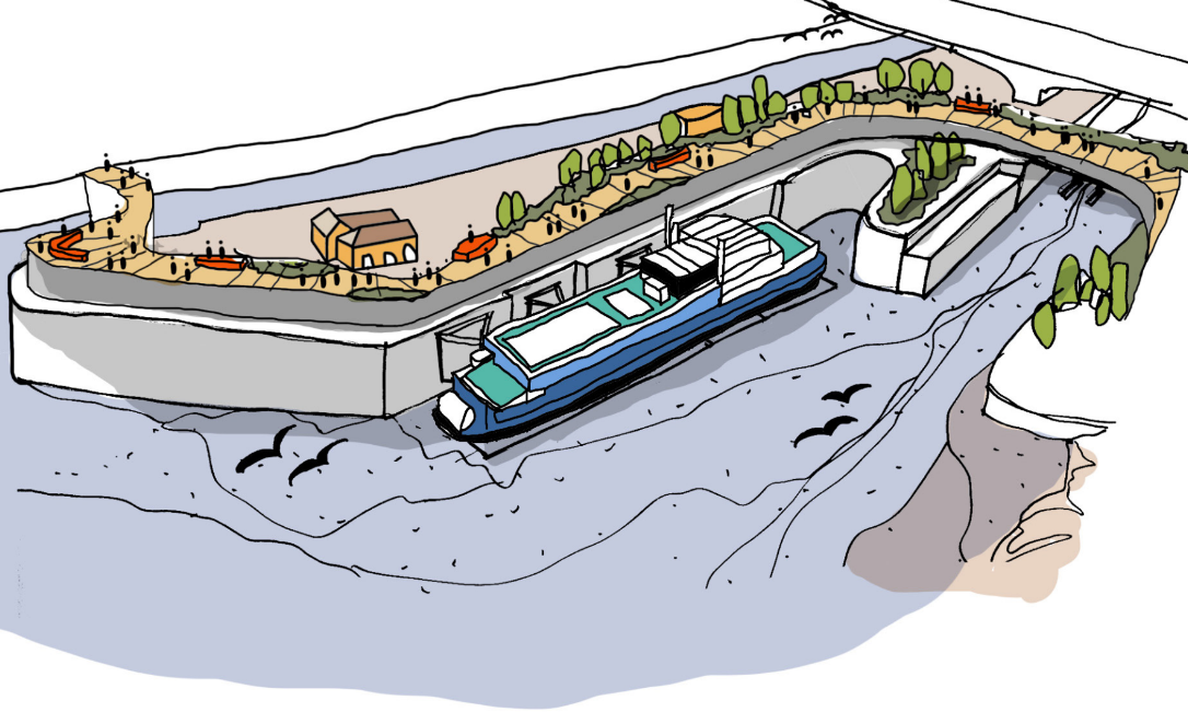
View of the flood walk at Butterfly Junction Park alongside A Bond at low tide - click to enlarge

View of the flood walk at Butterfly Junction Park alongside A Bond during an extreme flood - click to enlarge
The options for the silt flats by the Knuckle are to either dredge the river bed to expose the grid iron and historic dock or to maintain the silt landscape and enhance its biodiversity.
View of the grid iron, which is currently concealed by silt - click to enlarge
Option 1: View of the Knuckle at low tide showing disused grid iron and historic dock currently covered by silt. The new flood defence forms a cobb above the Knuckle - click to enlarge
Option 2: View of the Knuckle at low tide revealing an enhanced biodiverse habitat layered into the silt- click to enlarge
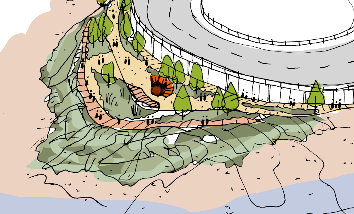
The Look-Out provides views of Avon Gorge and Clifton Suspension Bridge though access to it is limited and it is not a thriving location.
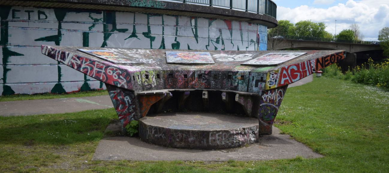
Image of The Look-Out - click to enlarge
View of The Look-Out at low tide - click to enlarge
View of The Look-Out during an extreme flood - click to enlarge